WEATHER FORECAST FOR TAMILNADU AND PUDUCHERRY
Yesterday Morning’s Low Pressure Area over north interior Tamil Nadu and neighborhood with the associated cyclonic circulation extending upto 5.8 km above mean sea level persists. Under the influence of cyclonic circulation over Gulf of Thailand & neighbourhood, a fresh Low Pressure Area is likely to form over south Andaman Sea and neighbourhood by today, the 13th November.
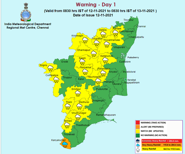
Thunderstorm with heavy rain is likely to occur at isolated places over Kanyakumari, Vellore, Ranipet, Tirupattur, Dharmapuri, Tiruvannamalai, Kallakurichi, Namakkal, Karur, Dindigul, Salem, Nilgiris, Coimbatore, Theni, Perambalur, Tiruchirapalli, Madurai, Virudhunagar and Thenkasi districts. Thunderstorm with moderate rain is also likely to occur at many places over rest Tamilnadu, Puducherry & Karaikal.
HEAVY RAINFALL WARNING
Heavy rain is likely to occur at isolated places over Kanyakumari, Vellore, Ranipet, Tirupattur, Dharmapuri, Tiruvannamalai, Kallakurichi, Namakkal, Karur, Dindigul, Salem, Nilgiris, Coimbatore, Theni, Perambalur, Tiruchirapalli, Madurai, Virudhunagar and Thenkasi districts.
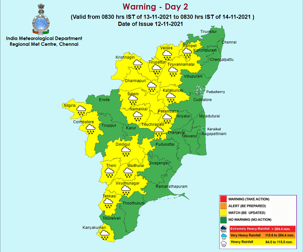
Heavy rainfall warning tomorrow: Heavy rain is likely to occur at isolated places over Tiruvallur, Chengalpattu, Kancheepuram, Ranipet, Krishnagiri, Tirupattur, Erode, Nilgiris, Coimbatore and Theni districts.
Reference: http://imdchennai.gov.in/tn_fc.pdf
http://www.imdchennai.gov.in/hrw_district.htm